Fennor
The Settlement and Architecture of Later Medieval, Slieveardagh, County Tipperary.
Richard Clutterbuck, Volume II
This thesis is presented in fulfilment of the regulations for the degree of M.Utt, in Archaeology, University College Dublin. Head of Department: Supervisors: Prof. Barry Raftery, Dr. Tadhg O’Keeffe, Dr. Muiris O’Sullivan, – August 1998
Fennor Castle Fennor Td., Fennor Pr., 43/1, S 262 622, Tl043-00301, 2/1998
Location Fennor town1and is situated in the northern section of the Slieveardagh on the side of high ground formed by glacial moraines. The castle was situated 180m east of Fennor church (23), 4.6km north-west of Kilcooly (31) and 7.3km north by north-east of Buolick (11). Fennor is part of a generally high arable producing area in the north of the barony, cOlTesponding with the grey brown podzolic soils of the well drained northern lowlands.
Fennor castle was sited at an altitude of approximately 146 metres on ground sloping. The site has an easterly aspect and is moderately exposed with some shelter from the ridge of high ground to the west. The castle was 169 metres east downhill from the nearest road.
History The castle belonged to the Butler family. It is recorded in the Civil Survey as being in the possession of Pierce Butler of Fennor who was the grandchild and heir of the Lord of IkelTin in 1641; the castle and bawn were recorded as being lived in for 1654 (Civil Survey I, 101, 120). The Down Survey depicts the castle with houses lying between it and the church.
Description Fennor castle was destroyed some years ago. The owner was unwilling to allow an inspection of the site. The castle was sited in the corner of a field. This corner appears to have retained the outline of the bawn (Fig. 47). Fennor castle was probably a tower house. The site was described in the Ordnance Survey Letters in the last century; the castle was 5′ 10″ thick and 40′ high with the north and west walls only standing (O.S. Letters Co. Tipperary I , 205). This works out at a wall thickness of 1.76m and a height of 12.12m.
Comment Other then saying Fennor castle was a tower house, little else can be said about the site. It was part of the parish centre settlement of Fennor (24) The bluntly pointed-arch connecting the chancel to the nave is constructed of cut and dressed limestone with chamfered edges with a projecting course or ledge at the spring of the arch for the thickness of the wall. The original entrance to the church was in the
Location Fennor is situated in the north of the study area on a ridge of glacial moraine in the northem lowlands (Fig. 3, 26). Fennor church is 4.8km north-west of Kilcooly abbey and 6km north by nOith-east of Buo1ick. Fennor church is also situated 180 metres south-west up hill from the site of Fennor castle (Fig. 24). Fennor church is sited at an altitude of 145 metres on the crest of a ridge of glacial moraine with an easterly aspect. The site is adjacent to a road.
Fennor Church, Fennor Td., Fennor Pr., 43/1, S 261 621, Tl043-00301, 2/1998
Fennor church’s chancel area has two sets of blank arcades on the north and south walls (0.8 metres deep and 2.45 metres wide) and once had a large vaulted arch on the east wall over the east window. The east wall gable, arch and chancel window have mostly been destroyed. The only remains of the chancel window are its ingoings. The arcades on the side walls were bluntly pointed. The south-east arcade had a window but the wall is breached at this point mostly destroying it. A stairs also rose from the eastern side of the south-east arcade and continued through the chancel wall arch over the east window. It is unclear where the stairs was going. Two corbels beneath the east window supported the altar. A recesses 0.9rn deep to the left of the original chancel window functioned as an aumbry. There is also a small recesses in the north-east blank arcade.
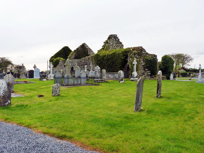
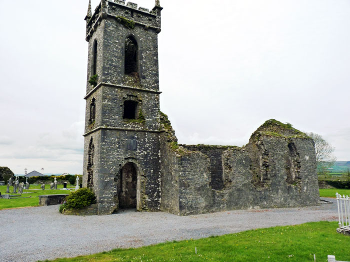
Description Fennor church is constructed of roughly coursed hammer-dressed sandstone with small amounts of limestone. The whole church measures 27 metres by 8.6 metres. externally and has a total width-to-length ratio of 3.2: 1. The interior of Fennor church consists ofthree sections divided by walls rising to gables (Fig. 23, Plate 21). The eastern and middle sections correspond to the chancel (7.75 metres internal length) and nave (8.15 metres internal length) and are connected by a bluntly pointed-arch (1.6m thick) (Fig. 22).
The width-to-1ength ratio of the combined nave and chancel is 2: 1. The third section in the west of the church is divided into ground with two vaulted chambers (maximum 7.15 metres internal length by 3.2 metres average internal width) and a first floor residential area.
History Fennor church was valued at 20 marks in 1302-07 (Cal. Doc. Ire. 1302-07, 286). By 1437 Fennor had become a prebend when Philippus Hedian was recorded as the prebendary (Seymour 1937, 329). In 1464 William O’Mu1warden, the Abbot of Kilcoo1y held the prebendary of Fennor (Ryan & Skehan 1966, 5) and probably used it along with his other interests to raise income, some of which no doubt went towards financing the reconstruction work at the Abbey. In 1506 Theobald Butler, a cleric of Cashe1 aged 12 was confirmed as the prebendary of Fennor in a papal mandate. Thady O/achynayn who claimed to be a priest had detained the prebendary apparently without title or the support of law since 1476 (Cal. Papal. Regis. xviii, 426). The prebendary of Fennor was held by William Flanagan a vicar of the Cathedral church at Cashel for some time before 1607. However by the time of this enquiry into the abuses of the diocese of Cashel and EmIy the position was vacant even though Flanagan had leased the prebend to Thomas Comelford for 21 years with a living valued at 40 marks per annum (Cal. State Papers Ire., 1606-08,239). In 1615
Fennor had no curate and no services and the church and chancel had at least lost their roof (Murphy 1912, 283). By the time of the Civil Survey in 1641 the vicar of the parish of Fennor is recorded as the proprietor of the glebe land which consisted of four acres to the west of the church enclosed by a ditch and valued at £1 (Civil Survey II , 400). The church and glebe land of Fennor is depicted in the Down Survey parish map from 1656.
Northern wall of the nave. The only architectural remains of the entrance is a portion of a draw bar hole in the wall. There was a window opposite the entrance in the south wall of the nave but this has mostly been destroyed.
The western third section of the Fennor church has two storeys. The ground floor is divided into two bluntly-pointed vaulted compartments. The vaults still retain the impression of the wicker centring and were interconnected by a square-headed door. The northern chamber could also be entered from the nave. The upper floors were reached by a flight of steps from the ground floor vaulted chamber. The stairs and both internal doors have been blocked. Each ground floor chamber can be accessed from the exterior through secondary entrances in their west walls. These have been insetted when the chambers were closed off from the rest of the church and converted into tomb vaults after the church had ceased to function as a place of worship. The southern chamber had a square-headed window of dressed limestone which has had its lower half removed when the door was inserted. The chamber is now closed off by a locked grill. Both chambers have a projecting course or ledge running along each walls length at the spring of the vault. A font has been set in the wall to the right of the secondary entrance of the northern chamber.
The stairs from the ground floor emerged half way along the eastern wall the first floor chamber. This chamber was lit by three windows: a double light with an ogee-head in the west wall and two windows in the north and south walls which have mostly been destroyed with the collapse of the walls. There appears to have been a projecting tower in the northeast comer of the chamber which survives as a short curving section of wall and some projecting masonry. The tower has collapsed leaving a slip in the wall. The feature has probably a stairs or garderobe. The first floor may also have been entered from the outside by wooden stairs through a door in the south-east comer of the chamber, possibly inserted at a later date.
The masonry has been robbed from the exterior south wall of the church; the church interior is still used for burial. The exterior ground level of the church has built up several feet above the interior level and burials have taken place right up against the wall. The burials both inside and outside the church have exposed large amounts of human bone. In fact its impossible to walk around the church without treading on the dead. Fresh graves are peppered with smashed bone. The southern boundary of the Fennor grave yard is rounded and the rest of the enclosure has been expanded to accommodate an enlarged grave yard with a nineteenth century Protestant church to the south of the medieval church.
Comment The design of Fennor church is unique for the study area. The church probably dates from the later medieval period; the sixteenth century judging from the design of the windows. The rounded southern boundary of the church yard indicates a possible pre-Norman church site. The over all width to length ratio for the church is larger then the other churches in the study area however the combined nave and chancel area have a ratio of 2:1 which is nearer the other parish churches (Ballinure (6) 1:2.6; Buolick (10) (before the secondary chancel) 2.4: 1. The only other site in the study area with a combined church and residence is Buolick church (fifteenth century). However Fennor differs from Buolick in that it does not have a tower. The line of the seventeenth century glebe field can still be made out in the modem field boundary to the west of the church (Fig. 47).
Upon these lands stands a good castle yeff the land is not impved. (Civil Survey I, 120)
Fennor castle was also recorded with a bawn wall (Civil Survey I, 101). The Down Survey parish map depicts the church and tower house of Fennor separated by three small cabins and a large irregular glebe field to the west of the church. The proprietor of Fennor townland and much of the parish was Pierce Butler, the grandchild and heir of Lord Ikerrin (Fig. 21). Pierce Butler lost his lands in the Cromwellian confiscation’s and William Begett was returned as the principle land owner in the townland in 1659 (Pender 1939, 295). In 1666/7 the townland had ten houses (Laffan 1911, 137).
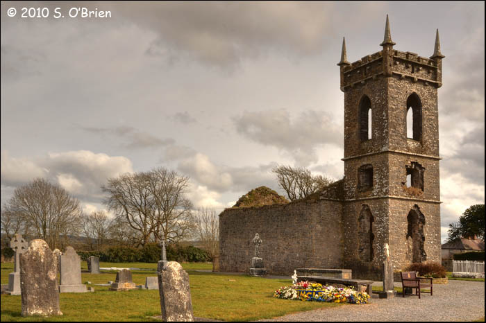
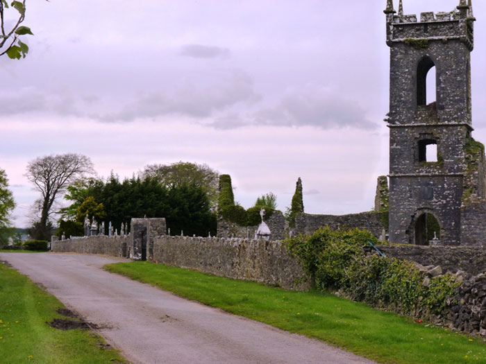
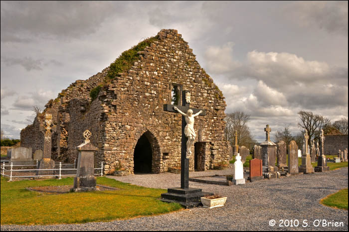
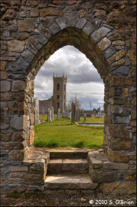
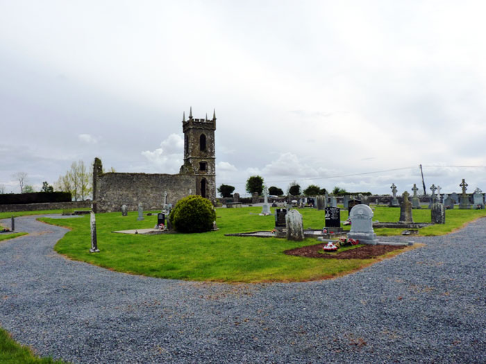
Description The most important items of the later medieval settlement in Fennor appear to have been the tower house (22) and church (23)(Fig. 47, Plate 21,22). The church of Fennor is still largely extant and consists of a stone built structure dating to the sixteenth century; the design of Fennor church is unusual for later medieval churches in Slieveardagh with a three-fold interior division, vaulting and domestic space in the western end of the church (Fig. 46). The northern boundary of Fennor church yard is curved, which may indicate the remains of a pre-Norman church enclosure.
Fennor tower house was sited 180 metres east, down hill from the church. The tower house was totally destroyed some time ago and unfortunately the site and surrounding fields were inaccessible to inspection, so that any remains of the tower or cabins depicted in the Down Survey parish map could not be identified. The Ordnance Survey letters from the nineteenth centUly state that the castle of Fennor was tall but with only the north and west walls survive (O.S Letters Co. Tipperary I, 205). The O.S 6″ map does show some evidence of the tower house and its bawn; the corner of the field in which the tower houses was sited follows part of the bawn wall’s original circuit. The modern field pattern to the west of the church also follows the outline of the seventeenth century glebe field, which survived as the property of the Protestant church into the nineteenth century.
Fennor Settlement, Fennor Td., Fennor Pr., 43/1, S 261 621, Tl043-003, 2/1998
Location Fennor parish is situated in the northern lowlands of Slieveardagh. The settlement was sited at an altitude of 145 lit, on a prominent ridge of well drained glacial moraine. The settlement had an easterly aspect, with the ridge as shelter. A series of roads run onto the ridge, with the main Dublin to Cork road running to the north below the ridge, following the line of an eighteenth century trunk road.
History Fennor appears to have been part of the manor of Incherothery (Inchirourke), the name of a townland in the north of the parish. In 1313 John de Fresingfeld, Knight, granted the manor to Sir Edmund Ie Botiller with all his tenements in the parish of Finnoure (Fennor) (Orm. Deeds I, 193). The parish church of Fennor had been included in the Ecclesiastical taxation of 1302 (Cal. State Papers Ire. 1302-07, 286) and Fennor appears to have had a market (Graham 1988, 31). When the Bruce invasion penetrated into county Tipperary the Sir Edmund Butler stationed his forces for several nights on his new manor of Fennor (Frame 1985, 364). A nucleated settlement at Fennor in the later medieval period is never actually alluded to by the historical record. The church of Fennor was described as a prebend in 1464, in the hands of William O’Mulwarden who was soon to become the Abbot of Kilcooly (3l)(Ryan & Skehan 1960, 5). By 1615 the church and chancel had lost their roof (Murphy 1912,283). In 1654 settlement at the centre of Fennor was described as:
Comment: Fennor parish centre was situated in a fertile area of Slieveardagh, with a good position with regard to accessibility to different types of terrain in Slieveardagh. The site of Fennor church was prominent and appears to have been chosen because of the existence of a pre-Norman church. Fennor was clearly important enough to merit a market in the initial century of the Anglo-Norman settlement; however the focus of the manor may have been on the townland of Inchirourke to the north. There is no evidence of a nucleated
settlement at the centre of Fennor in the later medieval period. The tower house of Fennor was separated from the church by 180 metres and appear to have taken advantage of the shelter provided by the hill rather then be exposed to the prevailing winds like the church. It would seem then that the centre of Fennor at least had a church, which had declined into a bad state of repair by the sixteenth century. The church may have been renovated with the construction of the tower house. Fennor tower house functioned then as a farmstead or estate of the !ken-in Butlers, with its own newly renovated parish church; the cabins depicted in the Down Survey were probably the out houses of the tower house or residences of tenants. However, these do not constitute a nucleated, multi-functional settlement.
Appreciation to both Sean O’Brien and Martin Maher for the Photo’s.

